Munt Müsella
|
Height: 2630 m.a.s.l Nation: Switzerland, Suisse, Schweiz Canton: Graubünden |
The Munt Müsella is a beautiful peak of the canton of Graubünden, located in the Engadin and overlooking the villages of La Punt and Zuoz, from the top you can admire a beautiful view towards the Engadin itself, also the area is rich in wildlife and it is not uncommon to see during the climb the many ungulates, especially roe deer, which inhabit the forests. An itinerary that presents medium difficulties and can be classified as MS / S2 / E1 |
GPX File:Munt Müsella.gpx
Climb
Altitude Difference: 930 m
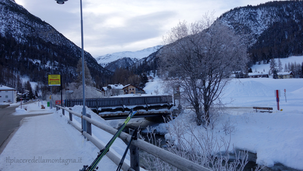
The route starts from the village of La Punt and develops on the north side of the valley. To reach the Punt just follow the Engadin from Sankt Moritz towards Zernez and get to the junction for the Albula pass, closed in the winter months, and just near the junction towards the Albula, we will turn right , cross a bridge and, following the main road, we will arrive near a series of parking lots, free of charge, but with a 12 hour drive, enough for our trip.
Once parked, we will continue to follow the road until we meet a bridge that leads to the only ski lift of La Punt, a ski lift, from where the climb will begin.
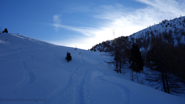
We will climb along the ski slopes until we reach the arrival of the ski lift that starts from the village, at the top we will enter the woods and follow a small road, unpaved in the summer months, which slightly climbs into the fir forest. At this juncture you have to pay close attention not to go into the woods, leaving the path, in fact you will find green signs on the fir trees that indicate the area as a protected area and where you can not enter in the winter months to protect wildlife, if you entered and were caught in the act, you would risk a high fine.
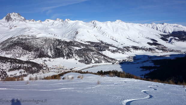
In these first moments of ascent we will already be able to admire the Engadine with its beautiful valley
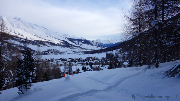
This part of the road is quite long and develops mostly flat, until we meet a junction where we will turn left and follow the climb towards the Alp Müsella. From now on the climb becomes challenging, the slopes increase considerably and we make a continuous series of turns inside the forest with the protected area that remains to our left. The challenging climb ends near Alpe Müsella
We will not reach the Alp Müsella, in fact, just before reaching it, we will turn right and face a second challenging part, in a more sparse forest where we will continue to climb performing a series of turns. Only once the forest has completely thinned out, we will climb straight, on fairly demanding slopes, until we reach the base of the Munt Müsella.
From now on it will be necessary to carefully evaluate the itinerary and the conditions of the snowpack, in fact we will face uphill some more exposed sections, where we must be sure if, before finding ourselves in difficulty, there is still about 150m of difference in height, but in addition to the climb we must also analyze the slopes from where to descend and evaluate any dangerousness.
From the top you can admire a beautiful panorama towards the Punt and the Engadine towards Zuoz.
Downhill:
From the top we will descend, if there are the necessary safety conditions, along a gully that leads us along the point where the wood had ended and we had begun to climb along the rocky ridges of the mountain, and then follow in parallel the climb track up to Alp Müsella, from here we will tend to keep to the left and descend along a sort of "gully" even in the middle of the vegetation, until we meet the flat road that we had left at the beginning; from now on we will be forced to follow it, because both the woods to our right and to our left, are part of the protected area, where we can not enter, we will reach the ski slopes..
To make you better see the descent and better understand the route, we leave you to our video.