Via della ganda(Cainallo - Rifugio Brioschi)
General Notes:
Altitude Difference: 1030 m
Time: 3h e 20'
Phisical Effort: Normal
Difficulty: E,except in the last 100m where becomes EE
Description:
The start of this route is located at the Vo of Moncodeno (1430 m.a.s.l.), a small plain located just above Cainallo, to reach it we must climb from Varenna to Esino Lario along the Agueglio pass,pass Esino and after about 2km from the village we will find the signs for Cainallo that will make us turn right,always following a wide and paved road.
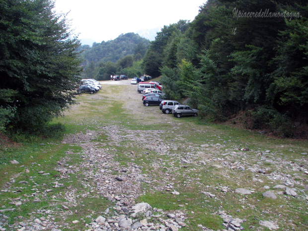
Once in Cainallo, from the junction are about 2km, we will always continue along the paved road to the Vo of Moncodeno,the road will become unpaved in the last 50 meters, where at its end we will find a large parking lot where to leave our cars, since 2014 the parking has become paid and to pay for it you need to take in the accommodation facilities of Esino or Cainallo a" Scratch card " from lascaire on the car.
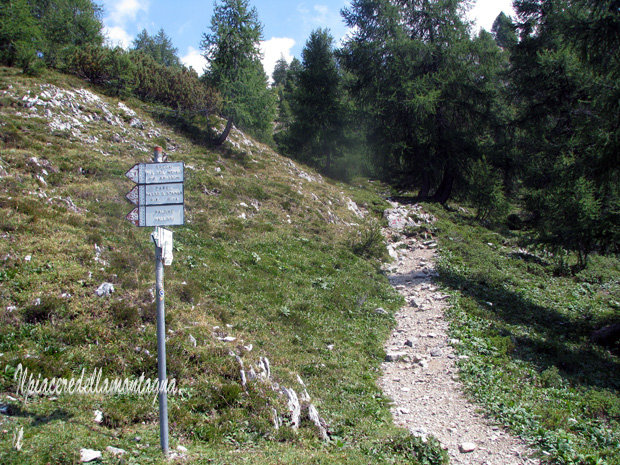
Once ready for our trek,we will have to climb for about 100m along a meadow where we will find on our right the signs with signs for Rifugio Bogani Brioschi,Rifugio Bietti Brioschi,Monte Croce.
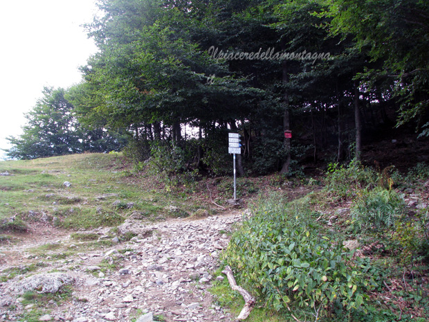
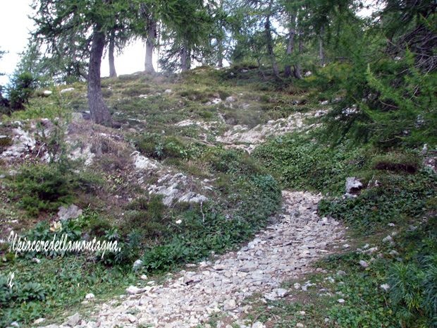
The path will immediately enter a beech forest, where we will turn the path will split, we will follow the path that goes up to the left along rocky boulders,while the path that goes up to Monte Croce on the right.
The path continues between continuous ups and downs undemanding for about 20', until we find a junction for Rifugio Bietti (nr24) and the Ridge of Piancaformia,at the junction we will continue straight following the signs for Rifugio Bogani,the path will tend to descend leading to the valley bottom of the Val delle Lavinie.
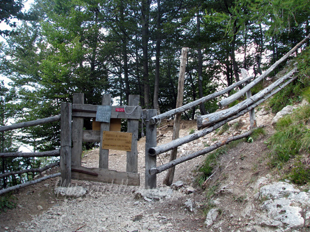
After about 10 ' of descent, we will start climbing again towards the Bogani, during the journey we will find a small gate, which prevents the animals of the huts from escaping,which bars the road,opening it and closing it we will pass it without any problem,now begins a fairly challenging first stretch in the middle of the larch woods that will take us up to Alpe Mondodeno(1700 m.a.s.l.), which we will overcome always keeping the right of the path.
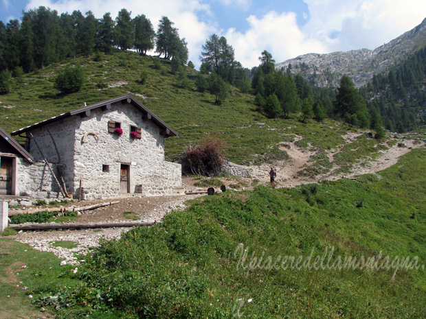
From the alpe in about 20' we will reach the Bogani refuge, which we will have to overcome and always follow the path number 25.
As soon as we pass the refuge we will find a junction with the paths that go to the Riva refuge where we should always go straight,we will find after about 10' that we walk on a rock a small bronze madonna.

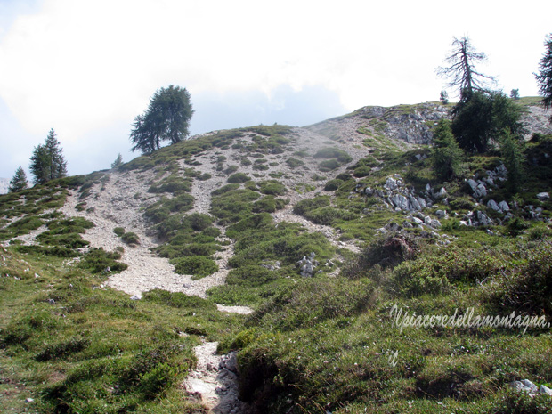
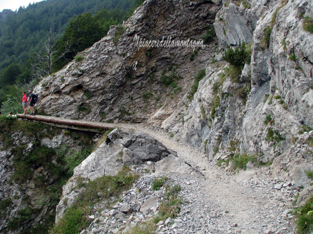
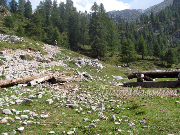
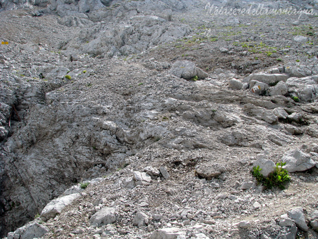
After which we enter the Grignone scree, during the path always visible with the various signs, between short pieces flat and uphill we will meet various crevasses, always well marked, where sometimes even in the summer seasons, we can find and see inside them still the snow of winter snowfall.
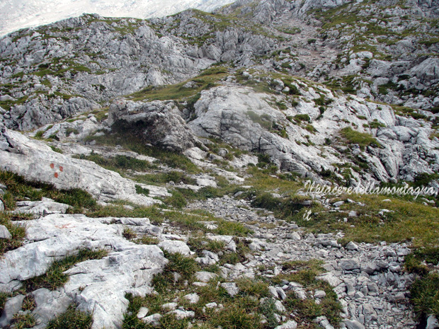
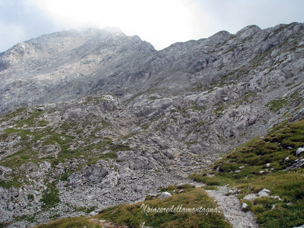
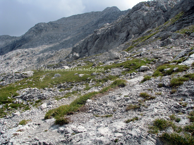
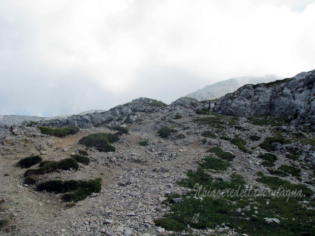
During these sections on gravel debris the path alternates very sloping uphill sections with small hairpin bends that help us, with flat sections, sometimes we have to climb small rocky boulders with the help of short and safe chains.
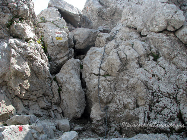
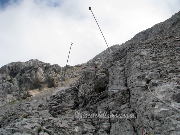
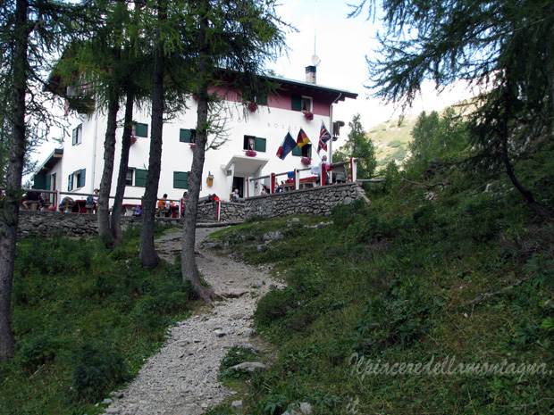
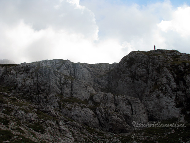
We can already see the refuge, the last 100 m are perhaps more challenging, we have to climb a very steep stretch on smooth but quite slippery rock,the chains placed here help us to climb regularly and without worrying about slipping,this stretch ends right near the refuge where there is a small chapel that precedes the refuge.
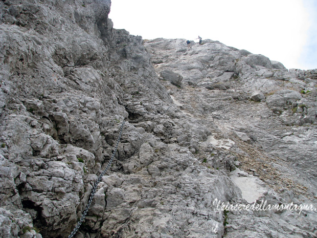
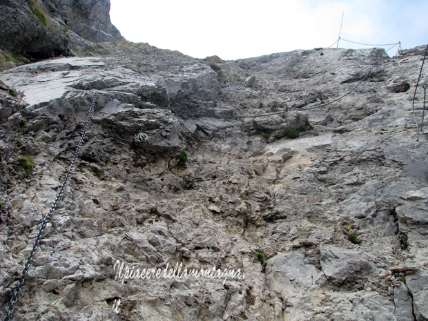

Uphill there should be no problems, more attention we must pay during the descent,for this only fairly complicated stretch, the completely smooth rock is very slippery, we should descend calmly and calmly.