Cusio - Rifugio Benigni (Refuge Benigni)
General Notes:
Altitude Difference: 687 m
Time: 2h
Phisical Effort: Normal
Difficulty: E
Description:
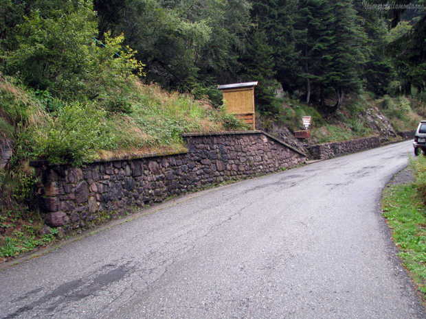
The start of this route is located near the baite di Sciocc, along the road that leads from Cusio to the Piani dell'avaro, to reach it just follow the road of the Valbrembana up to S. Giovanni Bianco and from there follow the road towards Passo S. Marco, for a short time up to the village of Olmo al Brembo where we will find the deviation for Cusio.
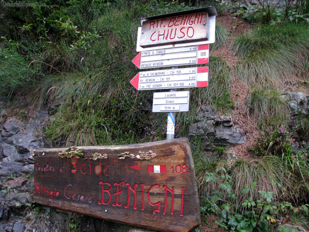
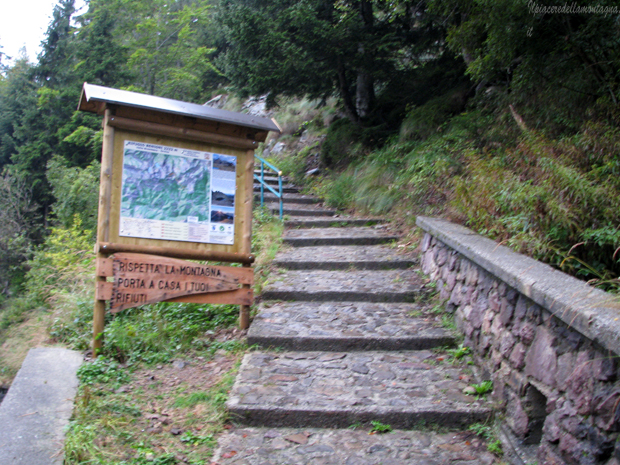
Always following the main road we will arrive in a short time at the starting point of the path,we will find as we go up on our left a staircase with a green railing and signs for the Rifugio Benigni with its open/closed state,here we will park at the edges of the road or on the hairpin bend below where we have more space.
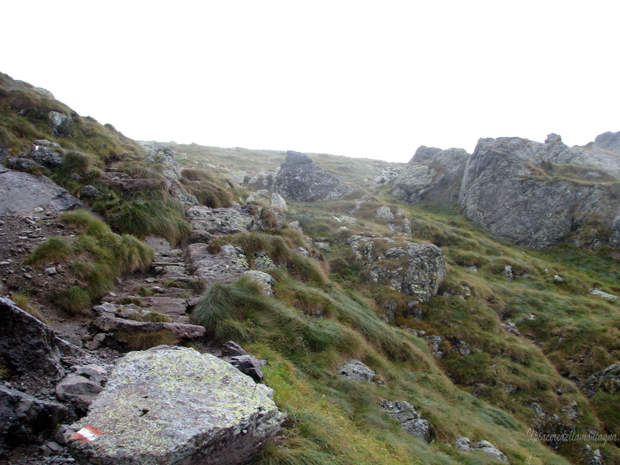
Once parked we walk along the short stone staircase that starts right from this point,the staircase lasts a few tens of meters and at the end of which begins a stretch of flat path, with short ups and downs and some crossings of streams that will lead us after crossing a short rocky stretch up to a small mountain pasture, Casera Valetto.
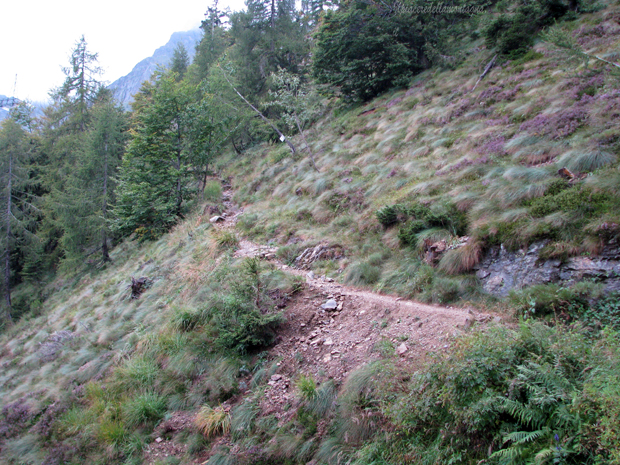
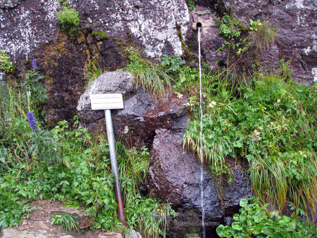
We will cross the casera and we will always keep to the right starting to climb along a small path that will pass the pastures of the alpine pasture, until we face a short stretch with extremely challenging slopes that in a short time will lead us to the Fonte di Carlo.
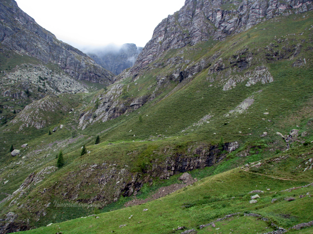
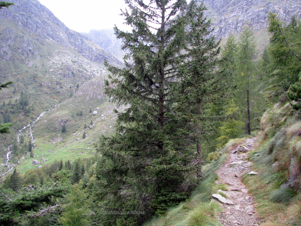
The path becomes a beautiful old mule track that with a series of hairpin bends goes up sometimes even with high slopes towards the Salmurano pass,we will meet during the climb a single stretch where the slopes decrease near a pasture,where there are also some benches and a sign with indications of the various routes of ascent of the Denti della Vecchia
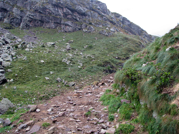
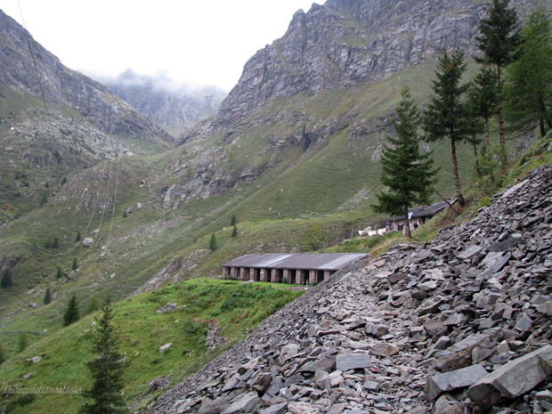
In a short time after passing a fairly exposed stretch of path, we will reach the famous gully that leads us up to the Benigni refuge,the gully does not present difficulties, the multiple trail signs indicate the easiest way to climb,and only in rare cases we have to help ourselves with our hands,during periods of heavy rains,from the gully descends a stream that does not create problems if properly equipped with the right shoes.
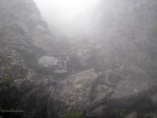
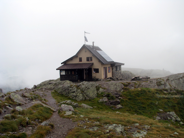
At the end of the gully we will immediately find signs for the Rifuge Benigni and the time that is missing to reach it: 15'; we will face a short flat stretch before the path increases its slopes even significantly,in the last meters we will also find a natural staircase that will lead us to the refuge;already at the end of the canal we will be able to glimpse the refuge and the flag that flies near it.
From the refuge there are many routes to the Valle d'Inferno, Pizzo dei Tre Signori, Rifuge Grassi, Pizzo Trona and all the other peaks that surround us, near the refuge we can see without major problems the herds of ibex that have made these areas their permanent home.